WEGA in the North West United States
May 29th to June 11th 2016
Day 10 - Tuesday 7th June 2016
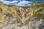
Our journey from Jackson to Green River crossed some nice scenery and some complex geology. To look at the geology would have required an excursion all to itself. The clearest explanation of what we crossed can be seen in Doug's notes which you can find HERE.
My unclear explanation is that we were encountering two orogenies which overlapped in both time and space. The Sevier orogeny is "thin-skinned" tectonics - compression resulting in thrust faulting in the upper crust - and the Laramide orogeny - more deep seated, characterised as thick-skinned tectonics and forming basement-cored mountains. The Sevier tends to be in the west, the Laramide in the east. Why you get the two different orogenies is probably due to the chance timings and particular characteristics of the regional plate tectonics - how fast did the Farallon plate move, at what angle did it enter the mantle and other things of which I know little and which may not yet have been thought of!
But much of what we saw in the latter part of the days journey may have been due to orogeny but showed little sign of it. The piling up of the Sevier thrust sheets depressed the area in front of them - flexural subsidence. The basins formed were often filled with lakes and these were filled with flat-lying sediments.

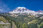
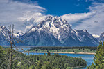
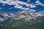
View from the summit of the Salt River Pass
The geology may have been interesting - it was certainly scenic - but we did not let it detain us on our way south. Our only pause was at the summit of the Salt River Pass. A description of the route can be found HERE. A geological map of the area can be seen HERE.
Eventually we came to Fossil Butte National Monument in time for lunch.

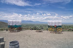
The picnic area at Fossil Butte

View from the Visitor Centre at Fossil Butte National Monument. And that is Fossil Butte!
Like all places run by the National Parks service Fossil Butte surpassed our expectations. There were explanations of the local geology, a display of the fossils for which the Monument was built and details of where they came from. And the Rangers were very pleased to talk to us about the environmental concerns of the area. It was a very good visit. Various photos of the visit are seen below.
Doug's explanation of the geology can be found HERE.

Inside the Visitor Centre.

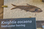
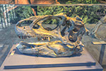
The characteristic fossil of Fossil Butte - Knightia eocaena - a sort of freshwater herring.

A selection of the fossils found near Fossil Butte


Fossil Butte Visitor Centre with the butte behind.
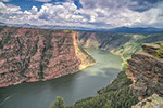
After leaving Fossil Butte we had a long drive to Green River where we were to spend the night. We passed many oil and gas wells presumably producing from below the Green River shales (see Doug's notes HERE). You can get figures for oil and gas production from THIS web site. Play around with the Chart tool using the spatial filter option to fine tune the results.
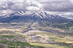
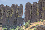
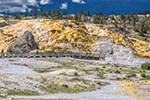
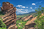
The hotel at Green River was not particularly special (except for being annoyingly far from town and disturbingly close to the noisy interstate) but its environs were more rugged than we were used to - see the next photo.

Two buttes just behind our hotel

WEGA in the North West United States