WEGA in the North West United States
Return to "Day" page
Return to Day 11 Page
Geological Background
DAY 11 UINTA MTS AND UINTA BASIN
The route from Manila to Vernal is known as the “Drive through the ages”, with sequences ranging from the Precambrian to Tertiary exposed, and identified by roadside markers. Just to the east of the route lies the Flaming Gorge area where the Green River has cut through the Phanerozoic sequences into the Proterozoic Uinta Mountain Group.
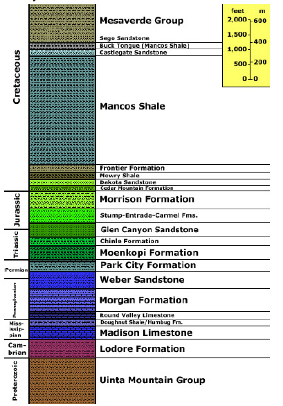
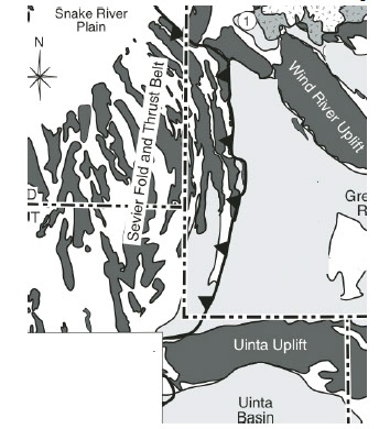
The Uinta Mts are one of uplifted basement blocks in the area of thick-skinned tectonics, with the Green River and Uinta basins lying to the north and south respectively. The range has 13 peaks that exceed 13,000’. The Uinta Group is composed of metasedimentary rocks deposited in an intracratonic basin in southwest Laurentia at the time of the breakup of the supercontinent Rodinia. The rocks are of Neoproterozoic age and are a 4 – 7 km thickness of quartzite, slate, shale and minor conglomerate. The sequence is interpreted as a large braided fluvial system flowing westward. The sequence has a red-bed character thus giving rise to the Flaming Gorge name.
The mountains have an anticlinal structure aligned E- W, and are bounded to the north and south by reverse faults that meet below the range, on the north by the North Flank fault and on the south by the Uinta Basin boundary fault. The north and south flanks of the east - west trending range contain a sequence of Palaeozoic and Mesozoic strata ranging from the Cambrian Lodore Formation to the Cretaceous Mancos Shale, all of which have been tilted during the basement uplift. This uplift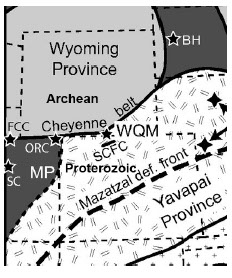 and the broad anticlinal structure is the result of Larimide compression.
The E-W alignment of the mountains is oblique to many other of the basement uplifts in this region, such as the Wind River or Bighorn uplifts, which trend NW-SE. The orientation is though to be controlled by a pre-exisiting basement heterogeneity representing the collision zone between the Wyoming Archean and Yavapai Proterozoic provinces. I suspect the diagram on the right explains this - or perhaps it doesn't!
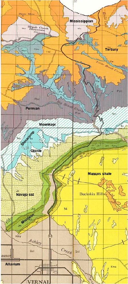
The route south from Manila towards the Precambrian Uinta mountains follows SR 44, going down the sequence from the Cretaceous Mancos shale and through the Jurassic into the Navajo sandstone, which are dipping north off the Uinta block.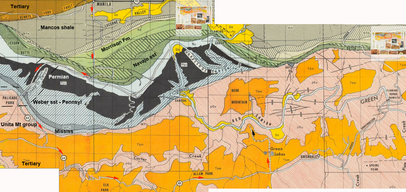
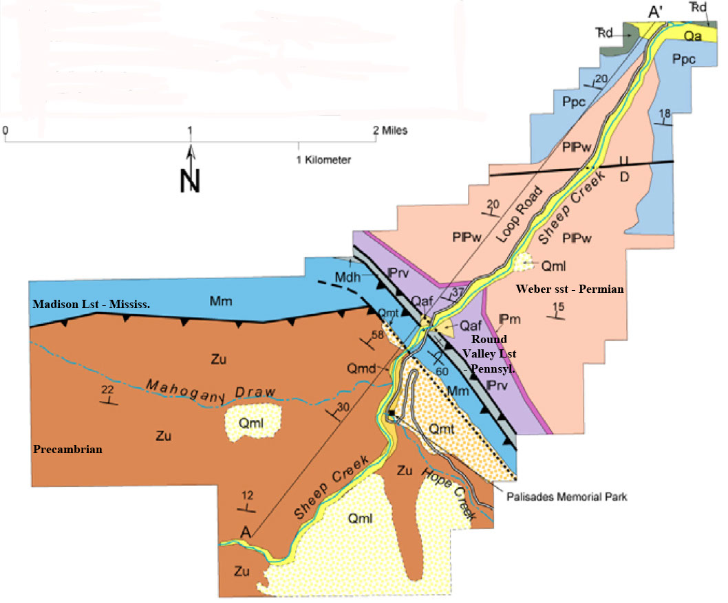
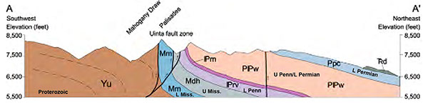 Where the SR 44 comes off the Jurassic and into the Triassic, the route turns west onto FR 218 into an the Sheep Creek Canyon that displays the North Flank fault system exposing the contact of the Uinta Group against the Mississippian Madison Limestone.
At the end of the loop road around Sheep Creek Canyon on FR218, the route rejoins SR 44 and onto the Flaming Gorge dam. From here the route goes south off the Uinta Mountains and south into the Uinta Basin.
Return to Day 11 Page
May 29th to June 11th 2016