WEGA in the North West United States
May 29th to June 11th 2016
Day 14 - Saturday 11th June 2016
This was the last day of our trip and did not contain a lot of geology. But there was a lot more people than we were used to! We were concentrating on the Rocky Mountain Front - the transition between the upthrust, older rocks of the Rockies and the flat lying sediments of the High Plains. Doug describes it HERE.
We drove southwards from Boulder, along the Front to where Interstate 70 comes through the front and into the Rockies.
The I-70 Roadcut. Looking eastwards over the high plains. The Rockies are behind us. The high point is the Dakota Formation with Morrison Formation on the left.
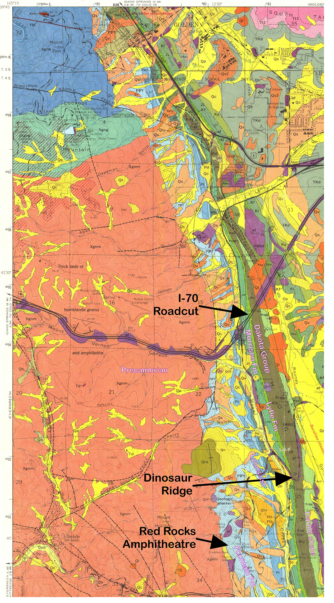
A geological map of the area, with various formations and locations marked, is given below. It is also seen on the Geological Background page.
After our experience at Dinosaur National Monument, Dinosaur Ridge was rather underwhelming! Here is a large bone of some sort.
At the Red Rocks Amphitheatre - looking south at the Rocky Mountain Front and a chain of flatirons. The rocks are Fountain Formation which are Upper Pennsylvanian to Permian in age.
The Red Rocks Amphitheatre. Denver is on the skyline, towards the left. John Denver played here, often. Also everyone else you have ever heard of!
Denver, through a telephoto lens, on the edge of the High Plains - unchanging geology all the way to the Mississippi and beyond!
Doug at Red Rocks Amphitheatre, doing the last geology of the trip, pointing to the faulted contact between late Pennsylvanian (Upper Carboniferous) Fountain Formation and Precambrian Gneiss
And that was that! We drove to the airport, got rid of the cars and checked in for our flight to London. And soon we were home.
You will have seen from this web site that all the geology comes via Dr. Doug Robinson who worked extremely hard to give us a permanent record of our trip and also to make it easy to understand when we were sitting on the outcrops. I think he succeeded!
WEGA in the North West United States
