WEGA in the North West United States
May 29th to June 11th 2016
Day 8 - Sunday 5th June 2016
Today we drove a circular route with the highlight of the day being our visit to Mammoth Hot Springs but there was much else to see.

Roaring Mountain
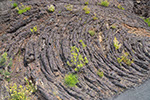
Roaring Mountain gets its name from the noises made by the fumaroles which hiss, roar, sigh or whistle. At least they may have once but it was rather quiet when we were there. The road has been moved farther away from the thermal area so that may explain the silence. But visually it is still very impressive. The bed rock is a hard tuff but has been transformed into a crumbly clay by the fumaroles and acid-sulphate seeps.
Our next scheduled stop was to be Obsidian Cliff but this proved difficult to find. Eventually, after driving back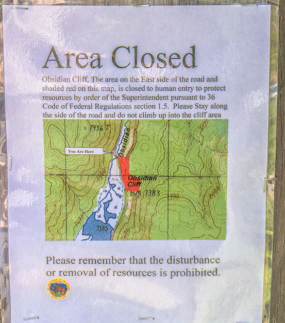
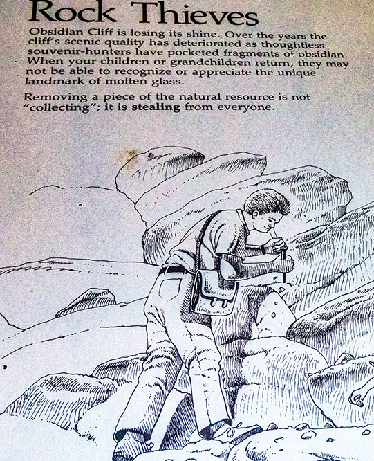 and forth along the road we found the explanation. Because of over enthusiastic rock collecting the obsidian was being removed from the park and the area was declared out of bounds to the public. But we were able to get a photo of the cliff, albeit from a distance. It was a pity we couldn't have seen it in more detail but you can read Doug's notes on the obsidian of Obsidian Cliff HERE.
 Obsidian Cliff as seen from the road
We set off once more for Mammoth passing Golden Gate where we move out of the Island Park Caldera, marked by the Huckleberry Ridge Tuff and a rather nice waterfall. We would see more of the Huckleberry Ridge later.
 Waterfall cutting through the Hucklebury Ridge Tuff at the northern edge of the Island Park Caldera
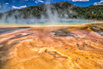
Then we arrived at the Mammoth Hot Springs. These differ from the other thermal areas of Yellowstone. They are not so hot , going up to only ~73°C! (The waters at Bath Hot Springs are about 47°C) Also the pH is neutral and instead of depositing sinter (SiO₂) they deposit travertine (CaCO₃). This is because, to quote Doug,
"the hydrothermal fluids travel through Mesozoic limestone at depth that they have this composition. Mammoth Hot Springs is the largest carbonate-depositing spring system in the world. Travertine here can be deposited at a rate of ~1 m per year! It is estimated that the groundwater spends 2,000 - 11,000 years in the hydrological cycle that penetrates the deeply buried Mississippian rocks."
 View of a travertine terrace at Mammoth Hot Springs - on Upper Terrace Loop Drive
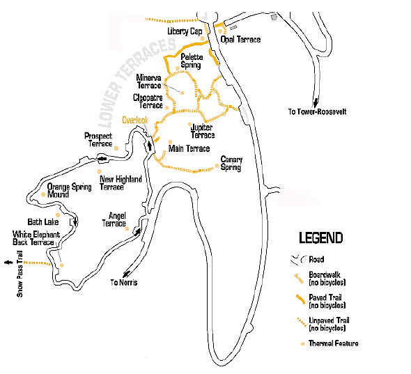
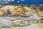
We drove around the extensive area of the travertine terraces and had lunch near Orange Spring Mound. My photos show what we saw and the captions attempt to make sense of them.

Orange Spring Mound. The orange colouring comes from bacteria in the water

Liberty Cap. This formed from a steady flow of hot water emerging from a single source, depositing dense layers of travertine. The cone continued to grow as long as there was a source of water. Either the hot water spring found a more convenient underground channel to escape through or the orifice became sealed by travertine deposits. The person who named it, noted “Locally, it apparently was known by a cruder name that did not find its way into print”. I wonder what he meant?

Liberty Cap and part of the Lower Terrace Area.

Older travertine being covered by newer, cleaner travertine

Detail of the travertine terraces. The white is pure calcium carbonate, the yellow shows the presence of thermophilic cyanobacteria

Various ages of travertine can be seen here.
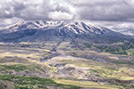
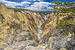
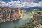
From Mammoth we headed eastwards until we got to the Yellowstone River once more. The river heads north from its beginning at Yellowstone Lake, heading towards the Missouri, then the Mississippi and the Gulf of Mexico. It is in a gorge, perhaps not as deep as we saw on our first day in Yellowstone but still spectacular.
On our, western, side of the gorge we were beside a 2.2 Ma (that is pre-Huckleberry Ridge) basalt lava flow with a thick entablature and narrow basal collonade. On the eastern side of the river were two other columnar basalts dating to 1.3Ma (Post-Huckleberry Ridge). Separating these flows are glacial outwash.

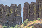
A Pre-Huckleberry Ridge basalt flow exhibits thick entablature and narrow basal colonnade

Across the Yellowstone a Post-Huckleberry Ridge lava flow rests on glacial outwash. Below that may be the brecciated top of another Post-Huckleberry ridge lava flow

A spire on the banks of the Yellowstone. The spire might be glacial outwash, but is more likely to be a volcanic breccia and be part of an underlying lava flow. It is beyond my skills to get closer and give a more definitive identification!

Looking southwards along the Yellowstone. On the bare slope at the top left you can see both lava flows.

Tower Falls with the towers which give it its name

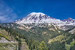
View from the lower slopes of Mount Washburn into the Yellowstone Caldera.
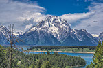
From Tower Falls we continued on our way over Mount Washburn. We were unable to get up to the top of the mountain as the old road to the 10,243 foot summit was closed. But on our way we had a good view over Yellowstone and into the caldera. The view southward includes the high Yellowstone Plateau, a landscape of younger (<200 ka) post-caldera rhyolitic lava flows that fill the caldera. The morphology of these units is distinctive in their steep flow fronts, hummocky tops, and aerial extent. These rhyolitic lava flows are some of the most voluminous on Earth in excess of several tens of cubic kilometres, extending up to 40 km from their source vents, and having thicknesses in excess of 100 m. In the distance is Yellowstone Lake, the largest high-altitude (i.e., >7000 feet elevation) lake in North America.

WEGA in the North West United States