WEGA in the North West United States
Return to "Day" page
Return to Day 12 Page
Geological Background
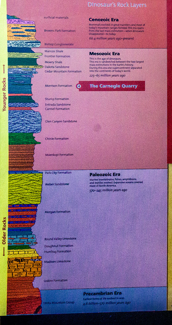
Dinosaur National Monument lies on the eastern margin of the Uinta Mts, which is a basement cored fault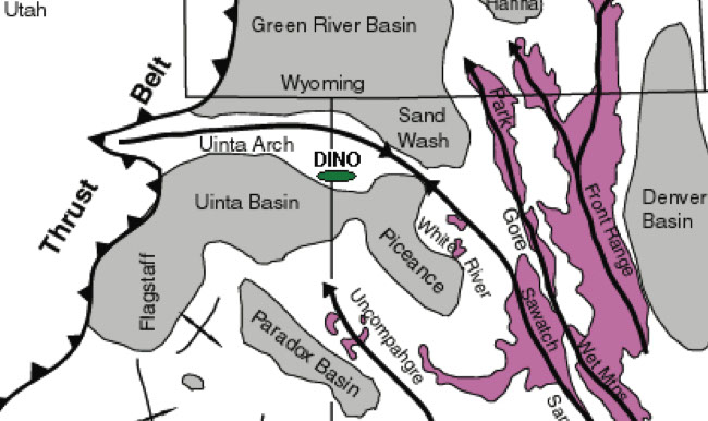 uplift. The Palaeozoic – Mesozoic rocks of the area have been folded into an E-W trending anticlinal structure that plunges west in the region of the Dinosaur quarry. The anticline has been deeply dissected by the Green River, thus giving rise to the name of Split Mountain. The anticlinal core exposes Mississippian rocks surround by successive envelopes of Permian, Triassic, Jurassic and Cretaceous rocks. The dinosaur quarry lies on the southern limb of the anticline with the sequences dipping steeply south. The main unit is which most of the dinosaur remains are found, and the site of the quarry is the Jurassic Morrison Fm.
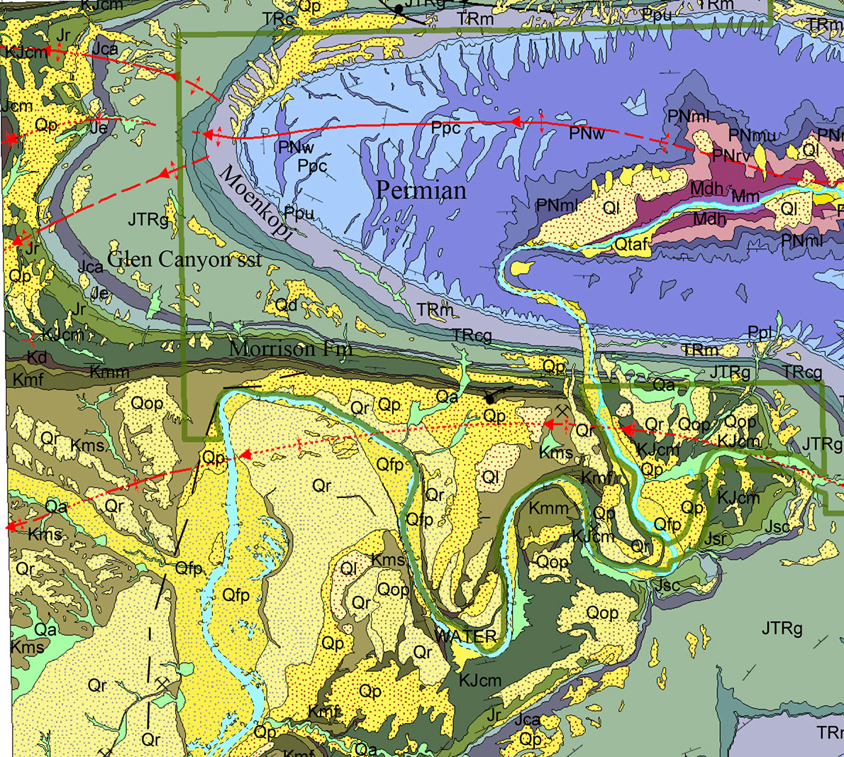
Kmf – Mancos shale; Kmm - Mowry shale; Kd - Dakota sst; KJcm – Morrison Fm; Jr – Stump Fm; Je – Entrada sst
The Discovery trail gives a good section from the mid-Jurassic, Stump Formation through to the mid-Cretaceous Frontier sandstone. The trail can be accessed from the Dinosaur quarry and leads back to the Visitor centre and is about 1 mile. The trail crosses steeply dipping sequences on the southern limb of the Split Mountain anticline. The oldest unit on the trail is the Jurassic Stump Formation, a marine silt and shale deposit rich in molluscs.
This is followed by the thick Morrison Formation, which is the dinosaur-bearing unit in the quarry. It represents a very variable semi-arid, subaerial environment with fluvial, lacustrine and saline lake deposits with abundant bentonite units formed from volcanic air-fall material. There is a short eastward spur off the main trail along the main sandstone in the Morrison in which dinosaur material is in situ.
The Morrison is followed by the Cedar Mountain Formation, which again represents a varied sub-aerial environment with conglomerate, sandstone, siltstone and claystone. There is an unconformity (20 Ma gap) between the underlying Morrison and the Cedar Mountain, marked by a calcrete surface. The next unit is the clear ridge of the Dakota sandstone, which is a transgressive/regressive setting of marine and sub-aerial deposits. The silvery grey Mowry unit follows, which is a shallow marine deposit rich in clay from volcanic air fall. It is also rich in disarticulated fish bones and scales. The final unit on the trail is the Frontier sandstone, a shallow marine regressive deposit.
A rather nice geological map of the Monument can be downloaded in PDF format HERE.
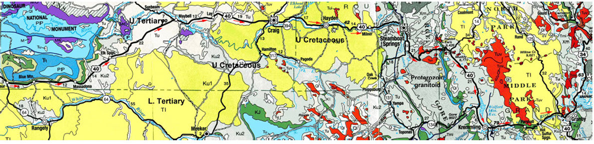
After leaving Dinosaur, the route heads eastwards across Mesozoic and Tertiary basins, and on to Milner where there is a dramatic change in the geology. Just east of Milner, the route passes from the Upper Cretaceous rocks onto Tertiary units and then ~ 4 miles south of Steamboat Springs as the road turns east, the route crosses into the area of the Front Ranges, which consist of large upfaulted blocks of crystalline Precambrian basement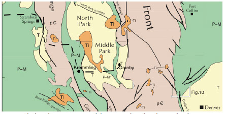 and intervening basins. The basement is upfaulted along major N-S faults that provide conduits for hot water to ascend and so give rise to the numerous springs in this area. As the route runs W-E over the Park Range of basement rocks, there are some exposures to the north and south of Tertiary volcanic rocks (33-23 Ma). One of these is Rabbits Ear to the north with the distinctive double towers. As US-40 turns from W-E to a more NNW-SSE direction, the sequence passes from the Basement rocks into an intervening N-S basin with first a thin outcrop of Triassic and Jurassic rocks and then into a larger area of Cretaceous rocks. Here the climb up to Muddy Pass at 8,722’ marks the climb across the Trias/Jurassic into the Cretaceous. The rest of the route into Granby crosses the Cretaceous and then east of Kremmling it enters Tertiary sequences to Granby.
These volcanic rocks are remnant of the Post-Laramide Magmatic event at 36-5 Ma. These are imposing erosional remnants of a once vast volcanic blanket that covered much of central and southwest Colorado in mid to late Tertiary time. This post-Laramide magmatism came in three distinct waves: the early and middle phases were dominated by explosive volcanism that spread ejecta across the state, now mostly eroded. The less violent late phase was largely basaltic flows ringed the margins of the Colorado Plateau.
This volcanic episode is attributed to a number of possible causes: upwelling of hot, buoyant mantle against the base of the North American plate as the Fallon plate broke off after its flat slab period during the Laramide event. Also there was resumption of normal-angle subduction rollback along the West Coast between 40 and 29 Ma would have caused further extension once again.
Return to Day 12 Page
May 29th to June 11th 2016