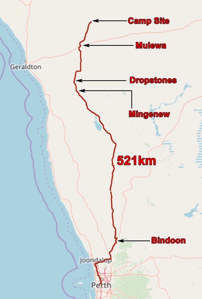
Our first stop (other than a coffee stop at Bindoon) was north of Mingenew to look for dropstones. These are rocks which were carried by icebergs into the ocean. When the iceberg melted the stones were dropped onto the ocean floor. Therefore they are usually very different from the rocks formed from the surrounding ocean sediments. And here the rocks around them are of Permian age! So we are dealing with a very ancient glaciation.

Our Toyota Landcruiser Prado, permanent 4 wheel drive, 3 litre diesel, 150 litre tank, 2 spare tyres, CB radio.

John explains dropstones to Chris

Julie is a geologist – you can tell by the hand use!
We continued northwards through the Wheat Belt. This is a huge area of farmland growing mainly wheat, unsurprisingly. It is very dependent on getting sufficient rainfall and, in the last decade, this has been hard to come by. But 2013 was the wettest year for a long time and the fields which had been planted were very green.
We stopped in Mullewa for fuel and continued northward until we spotted a likely spot for camping beside the Greenough River. We set up camp – collected firewood, got the swags out, set up the kitchen, put chairs round the campfire, and that is about it. Dinner was steak and baked potato, with red wine served in tin mugs. We felt very Australian.
We watched the stars, worked out South from the Southern Cross and the Pointer and went to bed. With little in the way of lighting it is early to bed and early to rise.

Chris looking at the stars.
The application below shows you various .kmz files. If you open them with Google Earth you will get our route and the photographs I took, at the spot I took them, displayed in all their glory! Download the file you want, store it somewhere on your computer, open Google Earth and open the file.
If you don’t have Google Earth you can get it HERE.
[slickr-flickr tag=”10-08-13″]