Thursday 19th and Friday 20th September 2013
This morning was a long, uneventful, drive into Port Hedland. By this time we were using cruise control and so passed the place of our speeding fine with an easy conscience.
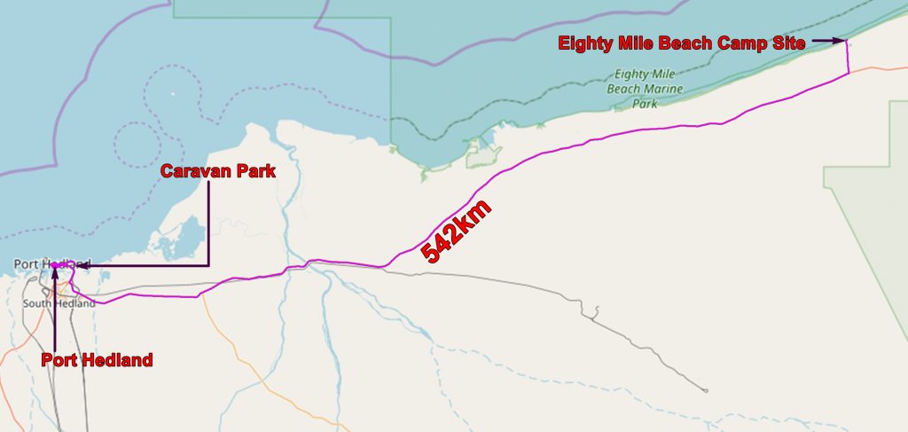

Geological map of Port Hedland with our route from Eighty Mile Beach superimposed
In Port Hedland we booked a tour of the port, spotted a dentist and booked an appointment for later that afternoon.
The tour of the port was very disappointing. We were not allowed off the bus, could not get near the interesting bits such as the rail wagon unloader and I think I knew more about the nature of the business than the guide. She did not know the capacities of the boats or how fast they could be loaded. Photos from the bus were poor – the best I have got is of an ore carrier passing the end of the main street of Port Hedland.

Huge Chinese ore carrier at the end of the street. Note the sign for the dentist.
I suspect that the reason that they are so reticent is that relations between BHP and the people of Port Hedland are not very good. Many of the workers on the site fly in to Port Hedland, work for their shifts and fly out to spend their money in Perth. Also the stacks of iron ore in the older part of the complex often cause dust problems and low level annoyance. BHP does not want to give any information which would cause them grief. But they are trying to move the dirty bits of the operation further away from the town.
Then off to the dentist where I had a replacement filling put in for A$255! Then to the camp site where, to celebrate my birthday, we hired a cabin which was very comfortable.
Then back downtown to have dinner at the Esplanade Hotel.
Friday 20th September
We left our comfortable chalet and went to the retail delights of Port Hedland – shopping and diesel at Woolworths. then a long and uneventful drive to Cossack.
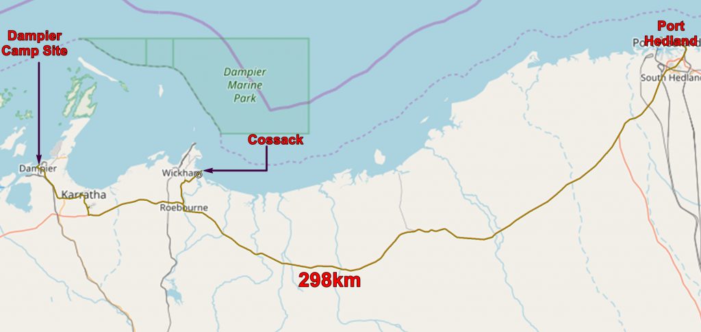

Geological map of an earlier part of our route from Port Hedland to Dampier

A tame pelican at Cossack wharf
Cossack is an old, almost abandoned, settlement which was once a centre for the pearling industry. A dangerous business – the highlight of Cossack are the graveyards, one European and one Japanese. But the highlight for us was a tame pelican which posed shamelessly.

Geological map of the latter part of our route from Port Hedland to Dampier
Then we drove to Dampier where we found the smallest camp site of our trip. We were next to a guy from Victoria who was in the area looking for a job – he was a mechanic of some description. He thought he could get a job very easily but was more worried about finding some place to stay. The camp site had a rule that you could only stay for three nights and no returns for a week.
This was typical of the mining and oil and gas areas of WA. Most hotels are filled with workers who fly in for one or two weeks then fly back to Perth. In many cases what are described as hotels are really a collection of dressed up shipping containers.
(We did hear of a few workers who stayed in Bali and flew on the frequent tourist planes between Perth and Bali – only three hours. For the same money you can live a much more luxurious lifestyle in Bali than you can in Perth.)
Because many of these towns will be abandoned when the mine closes, there is a reluctance to provide permanent facilities, release land for house building and establish communities.

The RTZ iron ore loading dock at Dampier. There are four ships here – they dock on both sides of the pier.
From the camp site we had a good view of the RTZ iron ore loading facilities. In the evening we saw a huge bulk carrier start being loaded. It was high in the water showing much of its underwater paint protection. When we got up next morning it was low in the water with hundred of thousands of tons of iron ore in its holds and getting ready to sail to China.

Ship being loaded with iron ore at the RTZ pier at Dampier. Note another ship on the other side of the dock.
The application below shows you various .kmz files. If you open them with Google Earth you will get our route and the photographs I took, at the spot I took them, displayed in all their glory! Download the file you want, store it somewhere on your computer, open Google Earth and open the file.
[slickr-flickr tag=”Dampier”]