28th to 30th August 2013
The southern part of the National Park is famous for the stripy domes. These had been known to the local population and occasional visitor for many years but were unknown to the outside world until sometime in the 1980′s when a film crew flew over and released a film which became, in modern terms, “viral”. Within ten years it was a National Park and in twenty it was a World Heritage Site.
Visiting the area lets you know that it deserves its status!
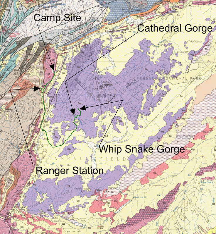
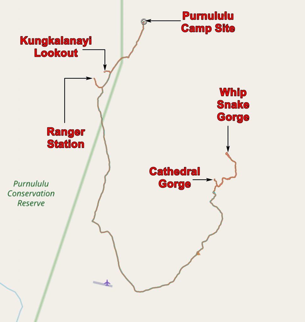
Here is a map of places we visited.
In the late afternoon of Wednesday the 28th we drove to the southern part of the range to get a first glimpse of the stripy domes and found them at their best in the evening light.

Stripy domes of the Bungle Bungles
They are all around.

More stripy domes

A stripy dome in the sunshine

More stripy domes
What is the cause of the stripiness? A close look at the rock shows that it is a surface phenomenon.

A red stripe with part of the iron stained surface broken off.
The red colour is easily explained – most of Western Australia is iron stained! Rain falls on the rocks and soaks in. It dissolves some of the iron oxide in the rock. The sun comes out, dries the rocks and the water with dissolved iron oxide comes to the surface. The water is evaporated, the iron oxide is left on the surface. It doesn’t take much iron oxide to give a very noticeable red crust.

A dark stripe showing the underlying white sandstone
The black or grey colour is less easily explained. Careful examination of the sandstone shows that it is not uniform. Some layers have slightly more clay content so when the sun shines after rain they stay damp for longer. And this encourages cyanobacteria to grow and this is black in colour.
So the red stripes are fairly pure sandstone; the black stripes are sandstone with some clay minerals.
The red and black crusts protect the sandstone from weathering and erosion when the rock layers form cliffs but not when they are horizontal. You can see this in the next photo; all the rocks are white sandstone but only the cliff faces are stripy.

Chris walking along the bed of the Piccaninney River.
But there is more to see than just stripes – there are multi storey termite nests! we saw these on our return on Thursday to the southern domes.

Termites nest climbing a stripy dome.

Another climbing termite nest

Setting sun on the domes
We also walked into Cathedral Gorge which is a rather wide gorge with an overhang and pool at its head.

Approaching Cathedral Gorge

Entering Cathedral Gorge

Under the overhang at the head of Cathedral Gorge
We also walked along the Piccaninny River to Whip Snake Gorge. As a gorge it is rather disappointing – we had been spoiled by the gorges of the previous day but scenery of the walk was breath taking. The temperatures of the walk were also breath taking – the white sandstone of the river bed reflected the heat and temperature were into the mid forties!

The bed of the Piccaninney River

View on the way to Whip Snake Gorge

Another view on the way to Whip Snake Gorge
On the way back to our camp site we stopped off at the Kungkalanayi Lookout to have another look at the Bungle Bungles in the evening light.

View north to where we were on Wednesday – the slot canyons.

The view from Kungkalanayi
The next day – Friday 30th August we drove to Lake Argyle. I drove the first bit and was able to get from the Ranger Station to the main road in five minutes less than Chris took. I just thought I would mention that.
It was on the Great Northern highway, heading north from the Bungle Bungles, that we had our nearest approach to an accident. Chris was driving and we were on a long bend with a big road train coming towards us. Then we noticed a 4×4 on our side of the road coming towards us! Most unexpected. Chris slammed on the brakes and steered for the side of the road. The idiot must have had his guardian angel watching as he squeezed between us and the front of the road train. It reminded us never to pass a road train on a bend.
We stopped at Kununurra to get some provisions and then carried on to the Lake Argyle camp site.
The application below shows you various .kmz files. If you open them with Google Earth you will get our route and the photographs I took, at the spot I took them, displayed in all their glory! Download the file you want, store it somewhere on your computer, open Google Earth and open the file.
[slickr-flickr tag=”Purnululu South”]