31st August to 1st September 2013
We arrived at the Lake Argyle Resort and found it to be a place in transition. Our route from Purnululu is HERE – open with Google Earth. It started as the construction camp for building the Ord River Dam which opened in 1972. So some of the facilities are rather tired. But there seems to have been a recent desire to raise the standard of the place. There are some new bungalows available (at a price) but the main improvement is the swimming pool. This is an infinity pool on the edge of a cliff overlooking Lake Argyle.

Chris in the infinity pool at Lake Argyle Resort
This pool has proved to be a great attraction for the resort and, we were told, will shortly be increased in size. we thought it was rather nice too – it was nice to wash the dust of the Bungle Bungles off!
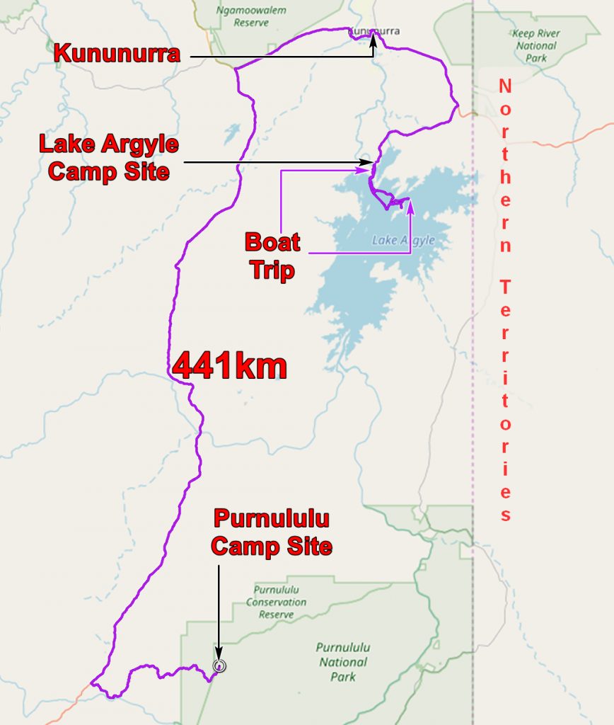
It had been a long drive to Lake Argyle. You can see part of our route on the following geological map.
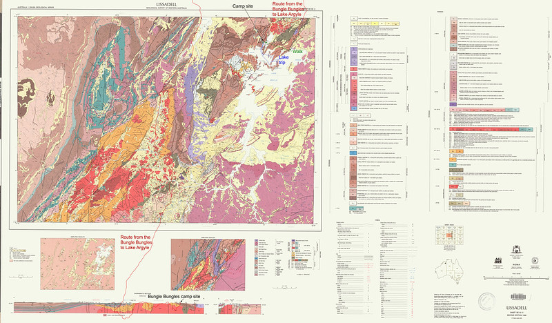
And below you can see a less cluttered view of the route.
The rocks are Proterozoic sandstones and are the basis of the beautiful rugged scenery of the area. The presence of Lake Argyle makes the scenery unique in Western Australia. We were used to going to great lengths to see a bit of water, hidden in some gorge or other – here it stretched to the horizon.
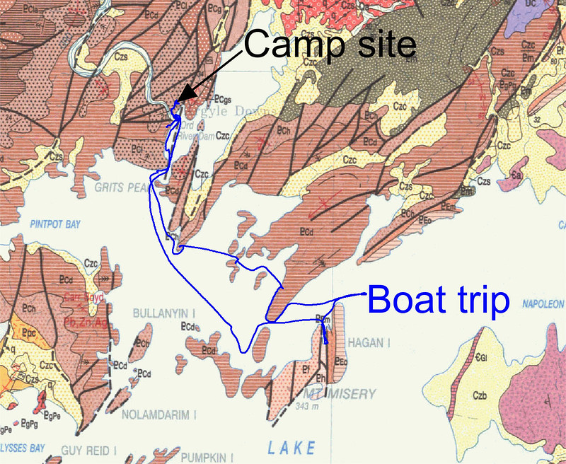
To see it at closer quarters we took the boat tour organised by the resort and found it to be well worth doing, mainly because of the enthusiasm of the boat skipper. He knew all there was to know about the lake, the dam, the islands and the animals living around the lake.
HERE is today’s route with photos. Open with Google Earth.

Our boat for the Lake Argyle excursion
We were on the boat for almost four hours and thought we had seen a lot of the lake but perusal of my GPS track showed we had seen only a tiny part of it.
Our first stop was just around the corner from where we set off, to look at a small Rock Wallabie which the skipper fed with pellets of animal feed. She had a joey but it refused to stick its head out although we could see its tail.

The Rock Wallabie
We then raced away across the lake and, looking back we could see the dam. The main design criteria for the dam was economy so it is made from local materials. The tyranny of distance decides almost everything in this part of Australia. The cost of getting things in – and out – controls everything. So the dam is made from local rock with an impermeable core of clay – and that comes from nearby too! The water is held back by the clay and the clay is supported and protected by the rocks. There is relatively little concrete used in the dam.

The Ord River Dam from the lake. The water is drawn off through the structure on the right. The spillway is not at the dam but several miles away.
The dam was built to reassure the farmers on the irrigated lands beyond Kununurra. If no rain falls for five years the dam can supply all the farmers needs for that period. A five year drought would be unprecedented. So the farmers will have faith that their continuing efforts will be rewarded.
The end to which they should direct their efforts has changed over the years. An early crop was rice, and this may be making a comeback. Cotton was grown until pest problems demanded ever increasing pesticide use. This, combined with a falling price greatly reduced its attractiveness as a crop. Sugar is still grown but the mill has closed. The cane is now exported to Indonesia. However there is a rum distillery which grows and processes its own sugar cane and makes a very nice rum. See HERE. Mangoes and melons are grown but the great hope is sandalwood. It takes a long time to grow – 15 years- but is currently of very high value. Transport costs – it is 3000 km. to Perth – make low value bulk products difficult. Efforts are being made to increase trade with Indonesia which is not very far away.
We continued out into the lake passing cliffs of folded Proterozoic Lissadell formation.

Folded Proterozoic Lissadell Formation, overlooking Lake Argyle
The lake, when full, contains enough water to fill Sydney Harbour 18 times. (This is the Australian National System of Volume Measurement. Somewhat more interesting than Olympic Swimming Pools and just as useful.) A whole ecosystem has evolved to exploit the water. We had the abundance of the fish population demonstrated by throwing some fish pellets into the lake.

Fish feeding time on Lake Argyle
We were assured that there were no Salt Water crocodiles in the Lake but there are many Freshies.

Fresh Water crocodile on Lake Argyle
Along the shores of the lake and, especially, on the islands, many animals prosper. Alien species can be prevented from invading the islands and, indeed, many islands were cleared of cats, dogs and other non-native species.

A euro on one of the Lake Argyle islands. Euros are a type of kangaroo adapted to the warmer climate of the northern parts of Australia. Notice the colour of the Euros is very similar to the rocks.
We learned a great deal about Lake Argyle on our trip and thought it was well worth the money. And we enjoyed the scenery too!

Evening light on Lake Argyle.
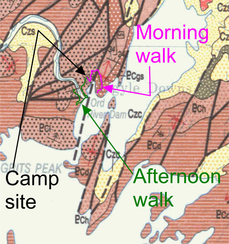
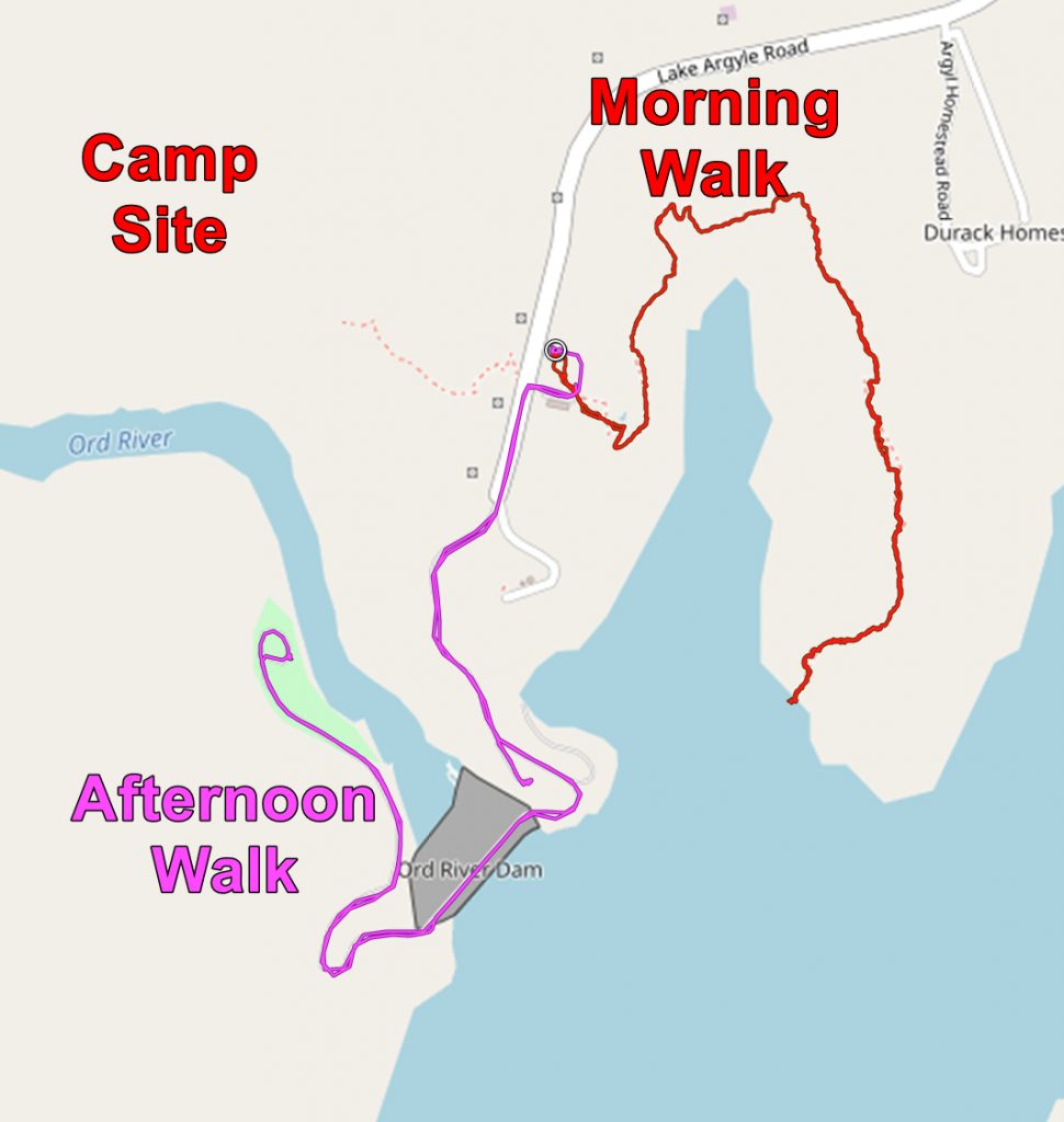
The next day we walked from the camp site round the bay. It does not look very much on the map but it took us a couple of hours.

The Lake Argyle Resort from across the bay
We could also see the dam.

The Ord River Dam
We were quite high up and so had good views over the lake.

Looking south over Lake Argyle
In the Afternoon we went to have a closer look at the dam and discovered that it is what it looks like – a gigantic pile of stones. It has a clay core but that has not been seen by the public since it was built. But it is a mightily impressive pile of stones!

The road across the top of the dam

The downstream side of the Ord River Dam
The application below shows you various .kmz files. If you open them with Google Earth you will get our route and the photographs I took, at the spot I took them, displayed in all their glory! Download the file you want, store it somewhere on your computer, open Google Earth and open the file.
[slickr-flickr tag=”Argyle”]