7th and 8th September 2013
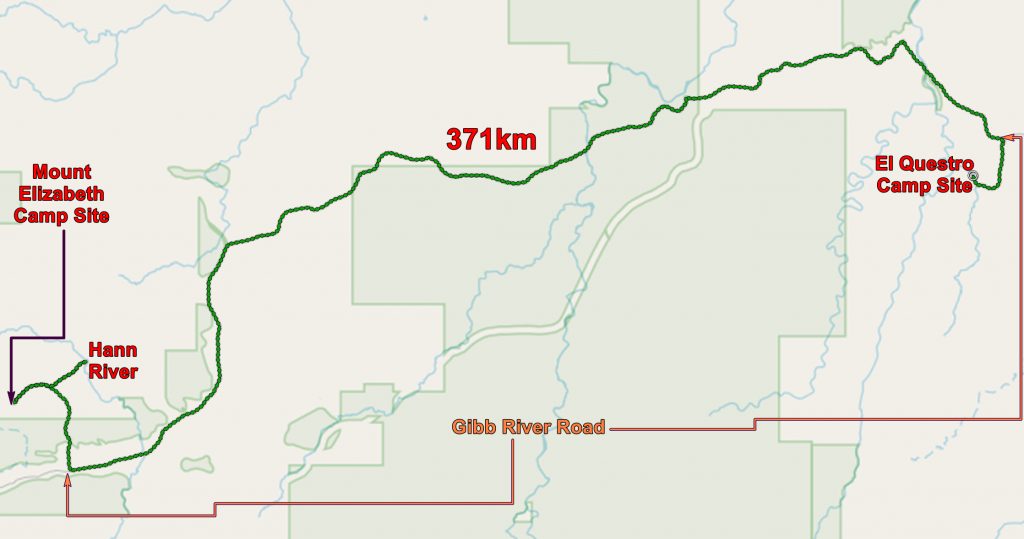
After a very pleasant stay at El Questro we set off for Mount Elizabeth Station which is 326 km along the Gibb River Road. This was a fairly easy drive with occasional bits of tarred road and lots of road works. Even crossing the Pentecost River was easy – there was very little water and we could not get our tyres wet!
HERE is today’s route with photos. Open with Google Earth.
Most of the way was over Proterozoic sandstones which give a rugged topography.
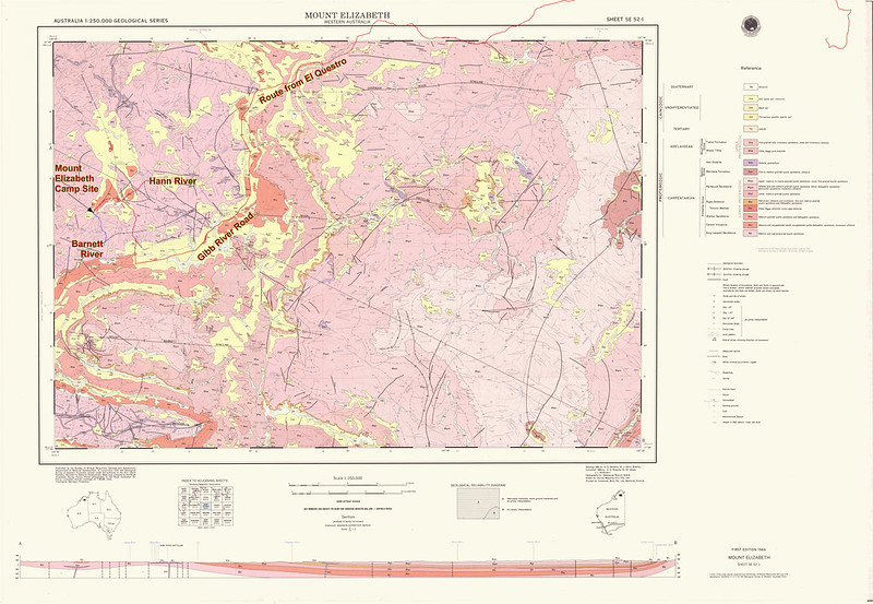
These geological maps, available for the whole of Australia, can be downloaded from HERE.
My expectations for Mount Elizabeth were rather low – we hadn’t stayed at any working farms and I worried that we would be regarded as nuisances. But when we got to the farm, twenty miles from the Gibb River Road, we found that the farm had recently finished its busy period – rounding up its cattle and sending many of them to market. So there was not much happening and we were the most exciting thing to happen that day! We were the only people at the camp site. However there were lots of little Wallabies and one, in particular, was extremely curious.

Wallaby at Mount Elizabeth Station camp site

The wallaby had a joey

Our camp site at Mount Elizabeth
We set up and, following the directions of the lady who signed us in, set off for the Hann River. This was a journey of twenty five miles there and back, but it was worth it as the stretch of the Hann River was lovely. We got there in the latter part of the afternoon and the low sunlight did wonderful things to the colours. And it was a very good place to swim!

Chris, the Hann River and the evening light
The next day we drove to the other highlight of Mount Elizabeth – the Barnett River.
HERE is today’s route with photos. Open with Google Earth.
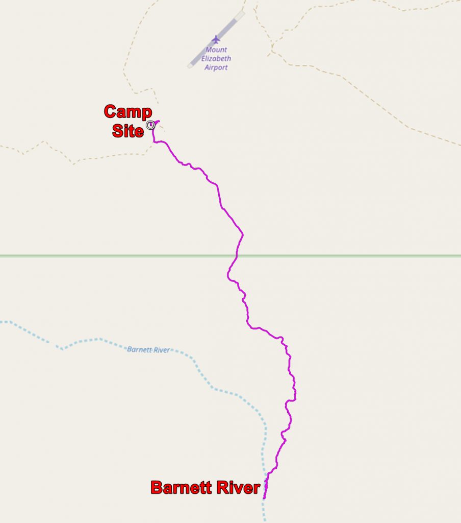
This involved a drive along a very rough track followed by a walk through the bush – about 7 miles in total. We may have got sweaty but the payoff made it well worth while. We found a wonderful swimming hole and an aboriginal art gallery!

The Barnett River at Mount Elizabeth Station. In the wet this would be a waterfall. Note the ladder for the convenience of the hordes of visitors.

The swimming hole at the Barnett River, Mount Elizabeth

Looking downriver at the swimming hole, Barnett River, Mount Elizabeth

Chris using the swimming hole, Wunnumurra Gorge, Barnett River, Mount Elizabeth Station.
If you walk a couple of hundred yards downstream from the swimming hole, you will find on the cliffs on the eastern side of the gorge some rather unusual aboriginal paintings.

Aboriginal art in the Wunnumurra Gorge, Barnett river, Mount Elizabeth. This photo is used as an illustration for “Indigenous Australian Art” on Wikipedia!

Chris at the Aboriginal art site, Wunnumurra Gorge

More art, from the same place

Parting look at the swimming hole
We spent several hours at the swimming hole then set off back to the camp site. A few more people had turned up, including a man who thought that we were insufficiently qualified to be alone in the bush. We had no idea of the dangers we were facing – did we take the track to the Barnett river without deflating our tyres?; did we know what to do if we were caught in a bush fire? etcetera etcetera. We refused to be impressed with his superior knowledge so he gave us up in disgust. Strangely enough he was travelling alone.
The application below shows you various .kmz files. If you open them with Google Earth you will get our route and the photographs I took, at the spot I took them, displayed in all their glory! Download the file you want, store it somewhere on your computer, open Google Earth and open the file.
[slickr-flickr tag=”Elizabeth”]