Wednesday 11th to Friday 13th September
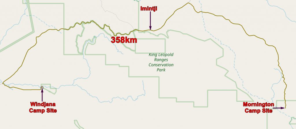
By this stage we were becoming old hands at breaking camp and we were soon on our way. It was 90km to the Gibb River Road and where we headed west. We stopped at Imintji for some supplies. There was some smoke from bush fires to be seen but we never felt in any danger.

Smoke from bush fires in the King Leopold Ranges
The Gibb River Road is largely dirt but it is characterised by occasional stretches of tar. Some of these are where the road is curvy but many others seem to be randomly distributed.

Geological map with our route to Windjana from Mornington superimposed. Also our activities at Windjana and our route to Derby and Broome.

Geological map, available for download
As we got nearer to Windjana Gorge we recognised a well known head.

Queen Victoria looks over Napier Downs
Shortly afterwards we passed a rubbish collection centre (where people can dump their rubbish from there cars and campers and keep The Kimberleys clean) and turned left towards Windana Gorge.
The quiet camp site (i.e. no generators) was almost empty so we were able to get a good spot under one of the few trees on the site. It had a good view of the reason we had come to Windjana – the Devonian Reef!

View of the Devonian Reef from our camp site at Windjana
After setting up our tent and having a badly needed cup of tea, we set off in the evening light to have a closer look at the reef. The Lennard River has eroded its way through the reef but there is a shorter way into the gorge. This is through a short cave which runs through the reef.
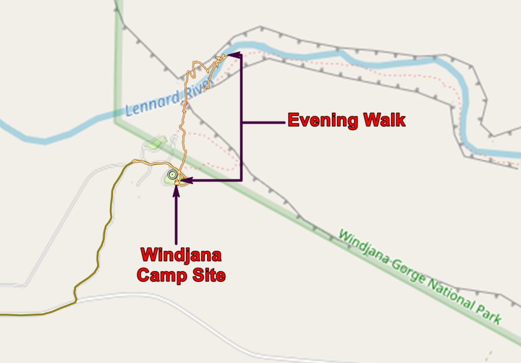

Chris taking the short cut through the reef to the Lennard River Gorge
We did not go far up the gorge as evening was approaching and there were a lot of freshwater crocs in the river who, while not deadly, need to be treated with respect! But we did see a fossil, possibly some sort of nautiloid. The books suggest that there are lots of fossils but we saw few – perhaps the good sites are not publicised so as to discourage collection by tourists.

“Our” fossil in the reef – it looks very like Figure 518 on page 370 in Bulletin 145 (see below)
Thursday 12th September 2013
We were up at the crack of dawn and walked into Windjana Gorge. It was very quiet at this time and the gorge is rather beautiful.
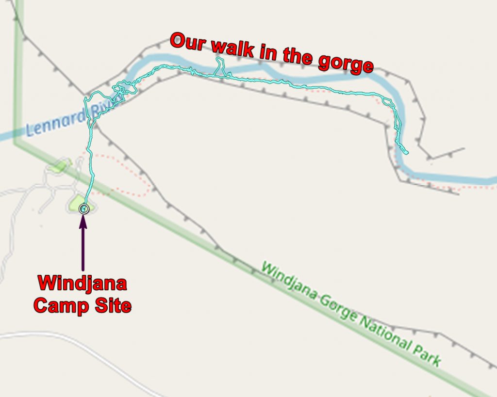

The banks of the Lennard River

The banks of the Lennard River, looking downstream to the entrance of the gorge
This was the dry season so the river was very low and scarcely flowing. There was a great deal of sand so walking was uncomfortable for persons like us wearing sandals or thongs (don’t get too excited – that’s flip-flops for us Brits!).

The walls of the gorge
Our reason for coming to Windjana was to look at the geology of the Devonian reef. The Geological Survey of Western Australia’s Bulletin 145 on the reef can be found HERE.
The bulletin will tell you far more than I can. Essentially it was a “coral” reef in the late Devonian period. Coral is in quotations as true corals were rare at that time but beasties which filled the same ecological niche were common and built something remarkably like a coral reef.

The Classic Face. This is a panoramic shot created from six individual photos.
The following are links to the six photos which you can download. Warning: – they are large files! Photo 1, Photo 2, Photo 3, Photo 4, Photo 5, Photo 6.
At The Classic Face we see a cross section through the reef. If you think of the Great Barrier Reef you can see that The Classic Face is a well exposed equivalent.
The reef itself is the bit against which the sea works, forming breakers. Bits are broken off the reef and these fall seawards forming a dipping fore reef of bits of broken reef. And behind the reef is an area of protected, shallow sea – a lagoon, in which flat lying coral – the back reef, is deposited. It gets uplifted (or sea level drops), eroded and then drowned again so another reef forms.
And then it all gets planed off so that the fore reef is at the same elevation as the reef.

The Classic Face annotated. This is based on a sketch on page 351 of Bulletin 145
Above I have put in various boundaries taken from a sketch in the WA Geol. Surv. bulletin 145. Consult this for an exhaustive discussion of the reef – it certainly impressed (and exhausted) me!

A Freshwater crocodile in the Lennard River
Having had a good look at the fossil reef we set off back to the camp site, passing many freshwater crocs.
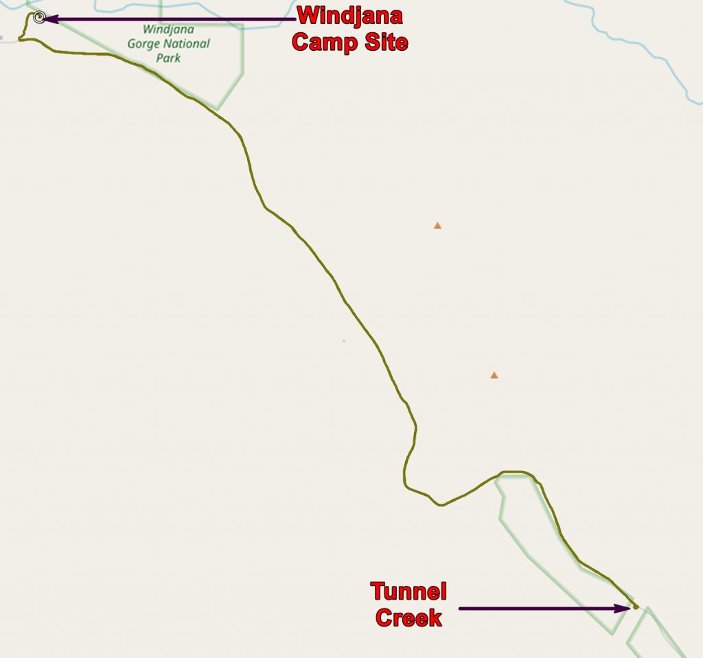
Back at camp we set off for Tunnel Creek which is where a stream runs through the reef forming a tunnel which you can walk and scramble through. It sounds more impressive than it is. Photographically it did not inspire me at all and we have been to “better” caves.
At any rate I took no photos and my only memory is looking at the tour buses. Because of the high price of these tours most of the people on them are rather old, but with a sprinkling of young bloods keen to see the great outdoors. It must make for tensions between the young and fit and the old and creaky.
On our way out we met a group racing through the cave and then passed a group of elderly who had got into the shade and were waiting for the young ones to come back so that they could get back on board the bus.
Also on the way to Tunnel Creek we stopped and helped a couple who had a flat tyre. Actually we did very little – we just stayed till they had the spare on and were good to go. We might have been of use if they had not been able to get the tyre on.

A Bower Bird nest at the camp site
Back at camp we found a group of people who had found a Bower Bird nest, right in the heart of the camp. The male bird builds and decorates an elaborate nest to attract a mate. I don’t know whether this one did the trick.
Friday 13th September, 2013
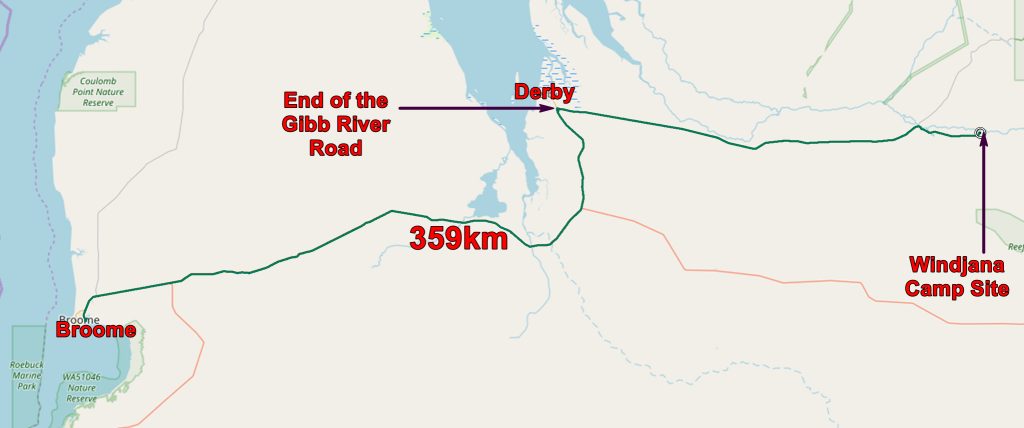

The boab prison tree, Derby. A hollow tree used as a prison.
The only thing of interest on the long flat drive was the Prison Boab Tree near Derby. In the late 19th century workers were needed for the mother of pearl industry in Broome and other places along the coast. So Aborigines were “recruited” (enslaved might be more accurate) from the Kimberley and marched to the coast. To discourage defection they were kept in places like the prison tree overnight on their march.
Soon we were in Broome where we booked in to a hotel for two nights.
The application below shows you various .kmz files. If you open them with Google Earth you will get our route and the photographs I took, at the spot I took them, displayed in all their glory! Download the file you want, store it somewhere on your computer, open Google Earth and open the file.
[slickr-flickr tag=”Windjana”]