by David R. Bridgland
Good morning all. Another fabulous day and an excursion into a wonderfully rural enclave inland from Kaş, before heading towards the coast and the ancient site at Myra.
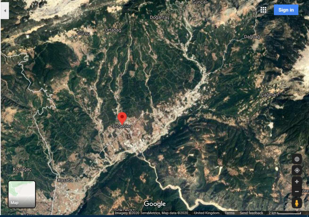
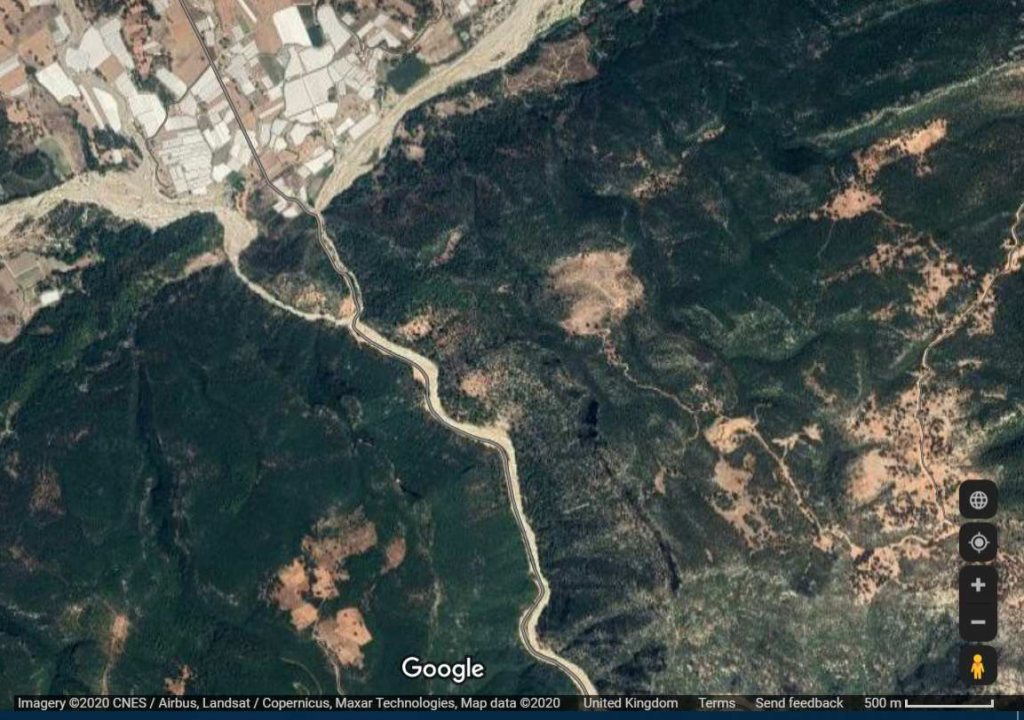
As Alison said, in 2016, during the days leading up to that year’s OUGS excursion, Rob Westaway and I, with some help from Alison, took a look at some river terrace evidence in the Kasaba valley, which is what we call the large low-lying intermontane basin system inland from Demre. In fact this is drained by numerous small gravelly rivers flowing from the mountains to the north and converging on the spectacular Dirgenler gorge, through which the coast at Demre is reached. Except that they don’t quite do that; the western ones and the eastern ones converge into rivers (the Demre Stream and the Boğluca Creek, respectively) that have separate gorges for a short distance and then converge in a confluence of gorges, a geomorphological phenomenon that can only have come about by superimposition of the drainage onto the pattern of geology that gives rise to the contrast between the intermontane basin and the limestone mountains through which the gorge is cut. Before I attempt to explain that I draw your attention to an English (Dorset) example of something similar – the two small rivers (the Corfe River and the Byle Brook) that have cut valleys through the Chalk to isolate the hill upon which Corfe Castle stands, only to join a little further downstream. Again, like the many deep valleys through the Chalk in southern England, this is attributed to superimposition of drainage. The similarity doesn’t end there: our Turkish example also sports a castle. We even climbed up to it to see whether there is any gravel up there; there isn’t. See my first two images, from Google Earth.
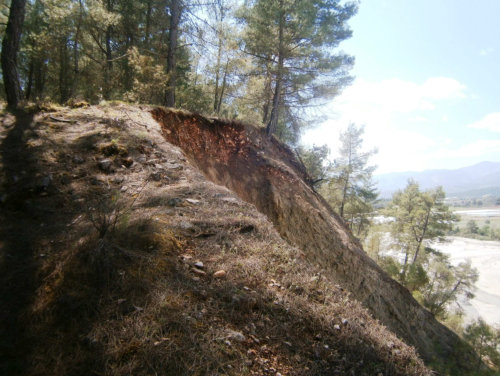
The explanation for the Dirgenler example is probably that the drainage pattern formed on basin-fill sediments, which underlie the intermontane lowlands and can be seen exposed in a number of places, the basin having been more extensive prior to denudation, formerly overlapping onto the harder limestone. When erosion exposed the limestone the separate streams cut down into it, locking them into their present courses, with the modern confluence marking the original boundary between basin-fill and limestone. These are of Cenozoic and Mesozoic ages, respectively, I think. The former include – yes, you’ve guessed it – gravels. Thus gravel can be found at considerable heights up the side of the mountains to the north, representing remnants of the basin-fill that once plugged this area but has now been largely eroded away, being relatively less resistant. These remnants can be seen looking across at the mountains, contrasting as they do with the harder lithologies of the mountains. It looks as though the fill never quite filled the basin before ‘inversion’ occurred and the basin-fill started to be eroded – something else that Rob and I have pontificated about (see that paper in the PGA). (See HERE.) The fill includes a full range of clastic sediments in addition to gravel, the latter being very similar to that in the modern stream beds and their terrace deposits (hardly surprising, as the hard rocks of the surrounding mountains represent the source in all cases).
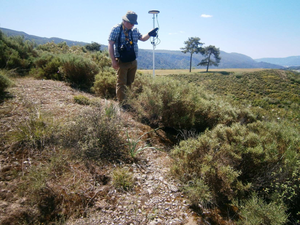
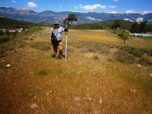
Now to the terraces. The floor of the Kasaba valley, between the modern gravel-bed streams, has many fragments of terrace gravel sheets at various heights, and often with very obvious downstream gradients. The lowest are the most extensive and best preserved, as would be expected. We suspect that these have no great age, although we have no way of dating them. Some are very fresh, looking as if the streams that once flowed over them left not long ago, although now they generally form platforms above nearby landscape. We did differential GPS measurements but have not yet found the time yet to write the work up. The overall impression is that these mark the latest stages of the aforementioned erosion of the basin-fill sediments. The streams have moved away from these gravels, which armour the otherwise soft basin-fill sediments, to erode into unprotected material, so preservation is quite good, at least in the short term.
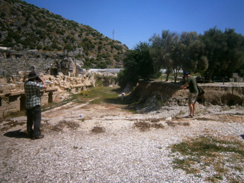
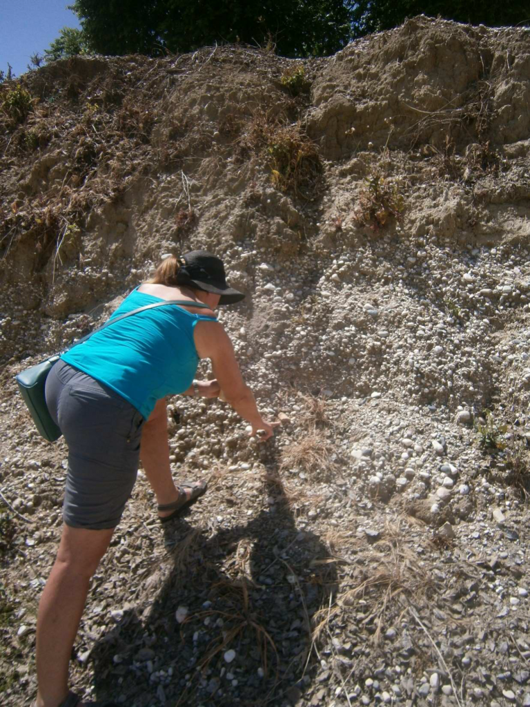
The uplift that has led to the inversion of the basin and formation of the terraces has also brought about erosion of the gorge, which is what rivers do when faced with resistant rocks; terraces only form when the river can move sideways, although they are sometimes preserved on the sides of gorges and, indeed, we can see some terrace remnants around the gorge confluence. We also get the impression that there is tectonic tilting here, with relative subsidence nearer the coast. This impression comes from the lowering of the gorge sides and the apparent burial of the valley floor in the lower gorge by gravel. This is well seen at Myra, where accumulation of gravel has continued since the construction of the ancient site. You will note that the theatre has been excavated from beneath gravel, full of artefacts and building stone fragments, which had swamped its lower few metres (see images 6 & 7).
Great weather, sea food and gravel! What a place!
All best